Geologists
Encom Discover v.12.0
Encom Discover is the desktop Geographical Information System (GIS) designed especially for the geosciences, providing the tools to effectively compile, visualise, analyse and map spatial geoscience data.
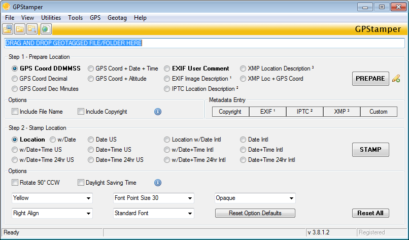
GPStamper v.3.8.3.0
Automatically extract from a geotagged imageOCOs metadata, and then visually imprint (stamp), the GPS position, location description, altitude, date, date and time, or any combination of these or any other file metadata, onto a photo with no loss in
Pages : All